|
Page 1 of 7 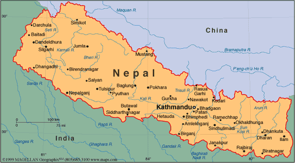
Official Name: State of Nepal
Area: 147,181 Sq Km (56,827 Sq Mi)
Altitude: From 70 Mts. in the flat parts of the Terai (shared boarder with India) to 8848 Mts. Mount Everest
Natural resources: quartz, water, timber, hydropower, scenic beauty, small deposits of lignite, copper, cobalt, iron ore
Land use: arable land: 17% / permanent crops: 0% / permanent pastures: 15% / forests and woodland: 42% / other: 26%
Irrigated land: 11,700 sq. km.(2003 est)
Natural hazards: severe thunderstorms, flooding, landslides, drought, and famine depending on the timing, intensity, and duration of the summer monsoons
Environment current issues: the almost total dependence on wood for fuel and cutting down trees to expand agricultural land without replanting has resulted in widespread deforestation; soil erosion; water pollution (use of contaminated water presents human health risks)
Estimated Population: 28,901,790 (July 2007 est) Time: Nepal time is 05 hrs. and 45 minutes ahead of GMT and 15 minutes ahead of IST (Indian Standard Time).
Calendar: Nepal has its own solar calendar (Bikram Sambat) counting the year 2057 (2000 according to western calendar). The new year starts middle of April. Dates for religious holidays and festivals are based on the phases of the moon.
|


